The Leesburg FSS had some problems last weekend.
When we went up the DelMarVa peninsula for Husband's birthday trip on Saturday, I had used the AOPA RTFP to file a VFR flight plan. At 10:14 am ET I called Leesburg Radio from ~2000' 2 nm north of JGG and opened the flight plan. When we got to GED, I called 1-800-WX-BRIEF to close it, and was on hold for 8 1/2 minutes.
It was the first time I had ever waited more than 2 rings for an answer. When that answer came, it was an automated (Lockheed) system instead of a person, also a first. Then the long hold time as I was assured that my call was important to them and that they were experiencing higher than usual call volume.
And I just figured the skies were crowded on such a gorgeous day!
Showing posts with label planning. Show all posts
Showing posts with label planning. Show all posts
Thursday, April 26, 2007
Friday, January 05, 2007
Solo x-c prep
[Update: Dammit, it's looking gusty tomorrow, with base winds near my x-wind limits...]
I'm hoping to finish out the solo x-c requirement tomorrow. I'd like to leave around 10 am, but right now they're saying a cloud deck at 1000' until lunchtime, so it may be delayed a tad.
The plan will be JGG->CHO->JGG for ~2 hours of flying time plus land/taxi/takeoff. I'll have to see how the Hobbs is going on the way home and maybe divert down to AKQ or something if the winds have shortened the trip. Or maybe go past JGG to PHF for the last towered airport landing. Or go JGG->CHO->PTB->JGG.
I just don't know! :) Depends on how the weather shapes up.
Wednesday, January 03, 2007
JEP FII-??: Night Cross-country
Goals:
Flight:
Tonight I had my first night training flight. After the long holiday, I had a bit of trouble getting in touch with Chuck, and I was feeling a little (self-imposed) rush to get night time in at the beginning of this week since there was a full moon and later in the week new storms were to roll in. When he did get back to me, he suggested I contact Dan (the instructor who did my phase check) since Chuck wouldn't be able to fly at night this week. I did so, and Dan was gracious enough to trade shifts at his part-time job to free up his evening for the lesson. We arranged to meet at the airport at 5:45 and for me to have planned a x-c down to ASJ (Tri-County Airport in Ahoskie, NC).
I got to the airport early and preflighted in the dark. That took about twice as long as usual, and I kept feeling disoriented with my checklist. I think this was because I couldn't just hold my finger in place and quickly glance down to see what was next on account of needing an extra hand for flashlight management. (I had grabbed Husband's hat with bill-clip light at home but somehow neglected to actually put it in my flight bag, stupid me.)
When Dan got back to the airport from helping a friend ferry a plane from another local airport, we met up and chatted for a while about night-flight topics. Empty-field myopia, where you stare at one spot and it kinda blanks out. Rods (movement) and cones (color) and using peripheral vision more. False horizons, and being diligent about checking instruments to keep oriented. Target fixation. The tendency to flare too high for landing and how to use the REILs to combat that. We looked over the route I had picked, then adjourned to 388.
After we hopped in and got situated, I started the next checklist, which begins with "Preflight inspection - complete." Since it had been 20-30 minutes since I did the preflight, I did a quick recall and remembered that I had chocked the plane (but not tied down) when I went to the flight school to meet Dan. Aha! Good. Hop out, unchock, re-situate. No embarassing attempts at departure with the wheels chocked!
After starting up, I spent a minute experimenting with lighting options. 388 has a fantastic red dome light that was beyond perfect for illuminating the instrument panel. Really, I wouldn't change a thing about that. For reading checklists and sectionals, however, it wasn't sufficient and I was regretting not having the hat light. I had two flashlights, one for a backup, and neither was particularly convenient to manage. One had a clip, so if I had a shirt pocket that might have been easy, but I had a thick fleece sweater on. The other had a short lanyard, wrist-sized, but a dangling device wasn't appealing. Dan's flashlight was on a neck lanyard, and that seemed like a workable arrangement, so I'll try that next time (or remember the hat!). I ended up holding the clip flashlight during the whole flight except for takeoffs and landings; that one has the push-the-end-for-temporary-light-or-twist-for-constant, and the push-style was most useful for short checks of the papers.
Eventually we got going. I always use the beacon and strobes, but Dan emphasized that they're required for night flight, which makes perfect sense. The landing lights were useful for taxiing, and my confidence in where the wings end was definitely compromised by the darkness! I thought my distance-judging skills were bad in the daylight -- that's nothing! Let's just say it was a slow, cautious and kinda tense taxi experience. Checking the rpm/oil/suction/amp gauges over in front of the right seat was more inconvenient in the dark during run-up, but not prohibitive. When ready to depart I flicked on the strobes and man are they bright. Dan recommended limiting their use to pattern and airport vicinity, and turning them on at the last moment before taking the runway. I'd have to agree -- the extreme contrast and flickering effect is pretty hard on the eyes.
I keyed the mike according to instruction to turn the lights on -- 7 in 5 seconds for high, 5 in 3 for medium, 3 in 1 for low, and 3 slow clicks to turn off the blinding runway strobes.
Takeoff was no different than normal. I suppose perhaps I'm used to giving some minor awareness to the periphery when rolling since deer and turkeys live in the area, but the limited visibility due to the night eliminated that possibility, kinda like a runway tunnel.
While climbing out, maybe around 300' and after checking gauges and instruments, I took in my first few quick glances of the night. It was really breathtaking. Huge full moon over the glistening river, woods and fields and streets, neighborhood lights, the brewery was shining in its pocket of woods, tiny aircraft lights way up high... Very special.
But no time for that yet! It was time to get the flight set up. As we crossed the river and continued to climb, I got set up on the 233 heading to AKQ (first checkpoint) and then called Leesburg Radio and opened the VFR flight plan. Next it was Norfolk Approach to pick up flight following, and quickly we were handed to another Norfolk frequency and then to Washington Center, who advised us of traffic at 12 o'clock that we already had in sight. It didn't take long to be able to pick out the green-and-white beacon of Wakefield -- it proved to be much easier to locate in the dark than it is in the day!
I leveled off at 6500' for the cruise portion of the trip. While working down to AKQ we played two "games." One was identifying landmarks outside and trying to find them on the sectional, and vice versa. There was a school that was well-lit and on the map. Thanks to the moon, the big straight cut of road that connects several towns on the southside was visible; also on the map and the main daytime indicator that AKQ is nearby. The second exercise addressed emergency landing site selection. Since Dan and I are both familiar enough with the area to know that the vast majority of fields down there -- easily identifiable in the glorious moonlight -- are flat and unobstructed, they provide an obvious option although they specific choice must be more guarded and having nearby alternatives would be more important since a last-minute rethink might be necessary. We talked about roads as an option, which many people don't like and which also must be considered with utmost care and reservation. If the moon wasn't so fantabulous, picking fields from woods from water would be more difficult and thus the emergency decisions would be much harder.
Oh, another aspect of this trip that was new to me was fuel tank management. The placard on our fuel selector says single-tank operation is needed over 5000'. As we passed through 5000' we were across the river and so I chatted it over with Dan for a minute and then reached down and clicked it to the right tank. This all happened very quickly: I felt it slip past the right tank (towards off!) ever so slightly, and was backing it up to rest in the notch when Dan took it and seated it. How did he know I had missed it? How did he possibly have time to get his hand down there between the time when I went past and started to go back? Literally, it was like 3/4 of a second. There was no change in performance. I understood that he'd check it after I switched, but the quickness with which he was on it surprised me. He did say right afterwards that had we gone for 10 seconds like that we'd be restarting the engine, but it would have been less than a second before I had seated it properly. I suppose he was ready to check it immediately after my switch so that I would not get first-hand experience in what happens when you screw up your fuel management, and that his response just came more quickly that I had anticipated. Anyway, I made a note of when the tank was switched.
We got to AKQ right on schedule. Sweet! (And I wonder why this time the DR worked out just right, whereas all my other attempts at DR to AKQ have failed miserably.) Next leg: 240 for 11 minutes to the town of Courtland, west of the town of Franklin, home of the Franklin-Rose Airport (FKN). FKN's beacon was easily visible from AKQ -- ~18 nm maybe. The towns were pretty easy to pick out based on size and relative locations. Awesome, going well. Well, almost going just right. We were two minutes late getting to Courtland. I adjusted the ETA for the next leg, a 6-nm hop to the teensy town of Newsoms, which we were skeptical that we'd even find: most of the stretch from FKN to ASJ is pretty empty.
We took a few minutes to talk again about false horizons and tricks our human eyes and brains play at night. Looking behind us at the peninsula, several things were apparent. For one, you can definitely tell where there's land v. water! Newport News and Hampton run together, wedged on the peninsula, and after a small break that is the James River entering the Chesapeake Bay, Norfolk and Chesapeake and other southern cities all clump together. We know that all of those city lights stop because the Atlantic ocean starts, but I could see how it would be easy to think they stopped because of a horizon. Another element of the city illusions was that the York River-bounded side of the peninsula runs basically at a diagonal, so I could also see how it would be disorienting to think that a line of city lights at a slant in front of darkness might be the horizon. Another thing was that some haze was apparent, and it somewhat blurred the line between land and sky. The haze was lit from above by the moon, and probably from below by the cities. We'd see more about this effect soon enough...
We did find something that we decided was Newsoms, and were two minutes late here as well. Our heading seemed ok still, so perhaps the wind had just picked up a little since I wrote up the numbers. With only 20 miles to the airport, I didn't think that trying to recalc in the dark while fumbling with a flashlight would be worth it. The next waypoint was Murfreesboro, a bastion of civilization in the VA/NC countryside, in 12 nm. A thin layer of clouds was forming up below us and to the east, and while we could probably see Murfreesboro, we decided it was time to descend to get a clear view of the ground and also just because of proximity to the destination. After alerting ATC of our intentions to descend to 3000' and being instructed to maintain VFR, I started the descent. The clouds proved to be at ~5000', and no course alteration was required to stay clear of them; they were entirely to our left, but in fact they were preventing a clear view of Murfreesboro. As we got lower we found that we were farther west of the town than planned, but could clearly see the ASJ beacon.
I continued our descent as we tuned in the AWOS to find calm winds. I chose to circle the airport and enter crosswind since we still had some altitude to lose for a landing on 19. My plan was that since no one else was around and the winds were calm and we wanted to go back north that I'd depart runway 1. The night pattern was normal, using the runway lights for reference was no different procedurally than using the runway itself, and the only part that was a little sketchy was not having a clear view of treetops on final, but Dan recommended a little extra precautionary altitude and it turned out just fine. I did use the VASI this time, and just after turning final was on the glide path it signaled, but then applied that little bit of extra height and so watched the double-whites until I could see the transition from dark trees to lighter (dead) grass, at which time the runway and the horizontal strip of red lights marking the other end became the focus.
Sooner than I anticipated Dan said to start my flare. The typical response for pilots new to night landings, I understand, is to flare too high, thinking they're lower than they actually are. Perhaps my feeble brain was overly aggressive in countering that impulse and went the other way. Turns out we were just right and had a very nice landing, slightly left of center.
I rolled to the end, and since no one was around I turned us around on the runway and quickly cleaned up, organized my papers for the next leg and prepared to depart. We took a quick look at the fuel selector (which had been switched back to both for the descent) and I gave it a practice turn in each direction before returning it to both.
We departed straight out and tuned in the FKN VOR for the return trip, estimated to take about 32 minutes that we'd fly at 3000' to ensure the clouds we saw on the way down couldn't increase below us going home. Radial 027 would take us to it from ASJ, then 034 would send us to JGG. Once established on 027, it was time to call FSS and close the JGG->ASJ flight plan. The Cofield VOR (CVI) was nearby and was a remote for Raleigh FSS but required transmitting on 122.1 and listening over the VOR freq. Dan dialed it in and made it the active nav freq. We identified the Morse code and then I tried to hail Raleigh.
In retrospect, I think Dan and I had miscommunicated about the frequencies -- obviously we were listening on the VOR freq (the Morse code was ID'd) and the com had 122.1 in it. I should have said "Raleigh Radio, 35388 is listening on", but instead Dan had said to tell them I was transmitting on 122.1. At the time I thought they shouldn't care what I'm transmitting on, they care what I'm listening on, but he's the instructor so I did as told and got no response, twice. Between tries, Dan tapped my VOR indicator which was showing the needle fully deflected to the right. I was surprised but couldn't eliminate the possibility that I had drifted that far since I was preoccupied with the nav and the sectional and whatnot and we were relatively close to the VOR. So I chased it with a good turn to the right and had probably gone through 45 degrees of heading before I realized that the wrong VOR was active in the nav. Duh. I pointed that out to Dan, who said "Good catch." That was probably a test. So I switched FKN back up to active and reaquired my radial, then back to CVI for attempt #2.
Dan's next suggestion was to pick up flight following and then we'd try another frequency for FSS. We were almost immediately handed off by Wash Center to Norfolk Approach, and next to nothing was going on on those airwaves, so Dan suggested just asking if they could close the flight plan for me. The fella had been super nice, so I was a little surprised when he didn't come back with an acknowledgement or anything. After a minute of silence, he asked if we had a number for it. That confused me, and I asked Dan if he meant something other than 1-800-Wx-Brief; Dan said just to tell him the outlet and see where it went from there. I said that we had filed with Leesburg Radio (shoulda just said Leesburg) and had been unable to hail anyone yet to close. After another few moments of silence he came back saying that Leesburg had my cancellation. I thanked him in the best sweet girl voice I could conjure.
Ok, back on track. Soon enough we were on the 034 radial outbound to JGG, leaving Franklin, with the Newport News sprawl getting closer. Dan pointed out the bend in the river with the power station brightly marking the southside point across from the airport, though we were still too far out to pick out the airport.
I was hoisted by my own petard again on this last bit. As we continued up, I was scanning and putting together the light puzzle, working from NN and the power station and all that, searching for the JGG beacon. Aha! A green flash. There it is; outside of the city lights so it's not PHF, too far up river to be Fort Eustis. So I consciously stopped holding my radial and headed for the beacon. As I made this decision, Dan was pointing out PHF and we chatted about the ILS clearances for inbound pilots we were hearing over the radio. A few minutes later, I reacquired the beacon and that's when I realized my folly: green-white-white. That was Fort Eustis, not JGG. Crap.
I admitted my mistake to Dan, who then asked me what I was going to do. The first plan that came to mind was to dial in the Harcum VOR, knowing that the 188 outbound radial was part of the instrument approach to JGG; that would be the backup. For visual acquisition, I'd need to look west of that FAF military beacon. By this time I could make out Jamestown Island and knew the airport to be just beyond it. But I couldn't see the airport yet, and neither of us found a beacon there. We agreed that we were basically there, so I cancelled flight following so we could switch over to CTAF and activate the runway lights. From out there I never saw the lights lining the runway, but the runway is a cut through the trees so that wasn't terribly surprising. What I did see, however, was a short, neat line of bright white lights that conceivably could be end lighting. Dan confirmed, so I began the descent. We were going to be way high, so I executed an S-turn over Jamestown Island to buy us some time. That was pretty weird, and didn't quite feel right in the dark. I thought back to the flight training articles warning that the vast majority of accidents happen during maneuvering flight.
But we got down and into the pattern for right 13 and it was just fine. The winds had picked up some and were blowing me into the runway pretty good, which I didn't notice until he pointed out that I was getting kinda close. I was looking back periodically to judge my position relative to the runway, but I admit that I was also trying to savor the last few moments of the first night flight and also taking stock of how the usual daytime visual queues for key pattern points are invisible. A little crab took care of that. On final I had a pretty good right crab in, but was happy with the stable track of runway centerline. Below the trees I was able to straighten out without having to slip (the trees broke the wind) and had a good landing.
And for the record, we never, ever saw the JGG beacon; perhaps it became inop. no NOTAM regarding its status before we left...
Discussion:
Self-Assessment: More polish, more practice!
Next: I've got the plane Saturday morning/afternoon for another x-c. I would like to do something different, but I've gone to most of the area that's in "short" cross-country distance. I was thinking of going back to Elizabeth City because it's an interesting flight and would get one of the two remaining required towered-airport landings (although maybe some of the 8 night landings will be at PHF). An alternative would be to fly up past Richmond and hit Charlottesville (also towered) and back. Either of those should easily get the 2.1 x-c hours I have left to do. But you know what I realize? I had been hung up on those numbers but now that it's FUN it seems so easy and kinda sad that they ONLY require 5 hours of x-c time! But the overhead of getting logbook endorsements and planning reviews... There'll be puh-lenty of x-c time after the checkride!
Hours logged total: 43.8 (38.1 counts toward reqs)
Instrument hours logged this lesson: 0.0
Instrument Hours logged total: 1.7
Take-offs and landings this flight: 2
Take-offs and landings total: 95
PIC (solo) hours total:: 11.7
- First night flight, with night landings, of course!
- Night x-c.
Flight:
Tonight I had my first night training flight. After the long holiday, I had a bit of trouble getting in touch with Chuck, and I was feeling a little (self-imposed) rush to get night time in at the beginning of this week since there was a full moon and later in the week new storms were to roll in. When he did get back to me, he suggested I contact Dan (the instructor who did my phase check) since Chuck wouldn't be able to fly at night this week. I did so, and Dan was gracious enough to trade shifts at his part-time job to free up his evening for the lesson. We arranged to meet at the airport at 5:45 and for me to have planned a x-c down to ASJ (Tri-County Airport in Ahoskie, NC).
I got to the airport early and preflighted in the dark. That took about twice as long as usual, and I kept feeling disoriented with my checklist. I think this was because I couldn't just hold my finger in place and quickly glance down to see what was next on account of needing an extra hand for flashlight management. (I had grabbed Husband's hat with bill-clip light at home but somehow neglected to actually put it in my flight bag, stupid me.)
When Dan got back to the airport from helping a friend ferry a plane from another local airport, we met up and chatted for a while about night-flight topics. Empty-field myopia, where you stare at one spot and it kinda blanks out. Rods (movement) and cones (color) and using peripheral vision more. False horizons, and being diligent about checking instruments to keep oriented. Target fixation. The tendency to flare too high for landing and how to use the REILs to combat that. We looked over the route I had picked, then adjourned to 388.
After we hopped in and got situated, I started the next checklist, which begins with "Preflight inspection - complete." Since it had been 20-30 minutes since I did the preflight, I did a quick recall and remembered that I had chocked the plane (but not tied down) when I went to the flight school to meet Dan. Aha! Good. Hop out, unchock, re-situate. No embarassing attempts at departure with the wheels chocked!
After starting up, I spent a minute experimenting with lighting options. 388 has a fantastic red dome light that was beyond perfect for illuminating the instrument panel. Really, I wouldn't change a thing about that. For reading checklists and sectionals, however, it wasn't sufficient and I was regretting not having the hat light. I had two flashlights, one for a backup, and neither was particularly convenient to manage. One had a clip, so if I had a shirt pocket that might have been easy, but I had a thick fleece sweater on. The other had a short lanyard, wrist-sized, but a dangling device wasn't appealing. Dan's flashlight was on a neck lanyard, and that seemed like a workable arrangement, so I'll try that next time (or remember the hat!). I ended up holding the clip flashlight during the whole flight except for takeoffs and landings; that one has the push-the-end-for-temporary-light-or-twist-for-constant, and the push-style was most useful for short checks of the papers.
Eventually we got going. I always use the beacon and strobes, but Dan emphasized that they're required for night flight, which makes perfect sense. The landing lights were useful for taxiing, and my confidence in where the wings end was definitely compromised by the darkness! I thought my distance-judging skills were bad in the daylight -- that's nothing! Let's just say it was a slow, cautious and kinda tense taxi experience. Checking the rpm/oil/suction/amp gauges over in front of the right seat was more inconvenient in the dark during run-up, but not prohibitive. When ready to depart I flicked on the strobes and man are they bright. Dan recommended limiting their use to pattern and airport vicinity, and turning them on at the last moment before taking the runway. I'd have to agree -- the extreme contrast and flickering effect is pretty hard on the eyes.
I keyed the mike according to instruction to turn the lights on -- 7 in 5 seconds for high, 5 in 3 for medium, 3 in 1 for low, and 3 slow clicks to turn off the blinding runway strobes.
Takeoff was no different than normal. I suppose perhaps I'm used to giving some minor awareness to the periphery when rolling since deer and turkeys live in the area, but the limited visibility due to the night eliminated that possibility, kinda like a runway tunnel.
While climbing out, maybe around 300' and after checking gauges and instruments, I took in my first few quick glances of the night. It was really breathtaking. Huge full moon over the glistening river, woods and fields and streets, neighborhood lights, the brewery was shining in its pocket of woods, tiny aircraft lights way up high... Very special.
But no time for that yet! It was time to get the flight set up. As we crossed the river and continued to climb, I got set up on the 233 heading to AKQ (first checkpoint) and then called Leesburg Radio and opened the VFR flight plan. Next it was Norfolk Approach to pick up flight following, and quickly we were handed to another Norfolk frequency and then to Washington Center, who advised us of traffic at 12 o'clock that we already had in sight. It didn't take long to be able to pick out the green-and-white beacon of Wakefield -- it proved to be much easier to locate in the dark than it is in the day!
I leveled off at 6500' for the cruise portion of the trip. While working down to AKQ we played two "games." One was identifying landmarks outside and trying to find them on the sectional, and vice versa. There was a school that was well-lit and on the map. Thanks to the moon, the big straight cut of road that connects several towns on the southside was visible; also on the map and the main daytime indicator that AKQ is nearby. The second exercise addressed emergency landing site selection. Since Dan and I are both familiar enough with the area to know that the vast majority of fields down there -- easily identifiable in the glorious moonlight -- are flat and unobstructed, they provide an obvious option although they specific choice must be more guarded and having nearby alternatives would be more important since a last-minute rethink might be necessary. We talked about roads as an option, which many people don't like and which also must be considered with utmost care and reservation. If the moon wasn't so fantabulous, picking fields from woods from water would be more difficult and thus the emergency decisions would be much harder.
Oh, another aspect of this trip that was new to me was fuel tank management. The placard on our fuel selector says single-tank operation is needed over 5000'. As we passed through 5000' we were across the river and so I chatted it over with Dan for a minute and then reached down and clicked it to the right tank. This all happened very quickly: I felt it slip past the right tank (towards off!) ever so slightly, and was backing it up to rest in the notch when Dan took it and seated it. How did he know I had missed it? How did he possibly have time to get his hand down there between the time when I went past and started to go back? Literally, it was like 3/4 of a second. There was no change in performance. I understood that he'd check it after I switched, but the quickness with which he was on it surprised me. He did say right afterwards that had we gone for 10 seconds like that we'd be restarting the engine, but it would have been less than a second before I had seated it properly. I suppose he was ready to check it immediately after my switch so that I would not get first-hand experience in what happens when you screw up your fuel management, and that his response just came more quickly that I had anticipated. Anyway, I made a note of when the tank was switched.
We got to AKQ right on schedule. Sweet! (And I wonder why this time the DR worked out just right, whereas all my other attempts at DR to AKQ have failed miserably.) Next leg: 240 for 11 minutes to the town of Courtland, west of the town of Franklin, home of the Franklin-Rose Airport (FKN). FKN's beacon was easily visible from AKQ -- ~18 nm maybe. The towns were pretty easy to pick out based on size and relative locations. Awesome, going well. Well, almost going just right. We were two minutes late getting to Courtland. I adjusted the ETA for the next leg, a 6-nm hop to the teensy town of Newsoms, which we were skeptical that we'd even find: most of the stretch from FKN to ASJ is pretty empty.
We took a few minutes to talk again about false horizons and tricks our human eyes and brains play at night. Looking behind us at the peninsula, several things were apparent. For one, you can definitely tell where there's land v. water! Newport News and Hampton run together, wedged on the peninsula, and after a small break that is the James River entering the Chesapeake Bay, Norfolk and Chesapeake and other southern cities all clump together. We know that all of those city lights stop because the Atlantic ocean starts, but I could see how it would be easy to think they stopped because of a horizon. Another element of the city illusions was that the York River-bounded side of the peninsula runs basically at a diagonal, so I could also see how it would be disorienting to think that a line of city lights at a slant in front of darkness might be the horizon. Another thing was that some haze was apparent, and it somewhat blurred the line between land and sky. The haze was lit from above by the moon, and probably from below by the cities. We'd see more about this effect soon enough...
We did find something that we decided was Newsoms, and were two minutes late here as well. Our heading seemed ok still, so perhaps the wind had just picked up a little since I wrote up the numbers. With only 20 miles to the airport, I didn't think that trying to recalc in the dark while fumbling with a flashlight would be worth it. The next waypoint was Murfreesboro, a bastion of civilization in the VA/NC countryside, in 12 nm. A thin layer of clouds was forming up below us and to the east, and while we could probably see Murfreesboro, we decided it was time to descend to get a clear view of the ground and also just because of proximity to the destination. After alerting ATC of our intentions to descend to 3000' and being instructed to maintain VFR, I started the descent. The clouds proved to be at ~5000', and no course alteration was required to stay clear of them; they were entirely to our left, but in fact they were preventing a clear view of Murfreesboro. As we got lower we found that we were farther west of the town than planned, but could clearly see the ASJ beacon.
I continued our descent as we tuned in the AWOS to find calm winds. I chose to circle the airport and enter crosswind since we still had some altitude to lose for a landing on 19. My plan was that since no one else was around and the winds were calm and we wanted to go back north that I'd depart runway 1. The night pattern was normal, using the runway lights for reference was no different procedurally than using the runway itself, and the only part that was a little sketchy was not having a clear view of treetops on final, but Dan recommended a little extra precautionary altitude and it turned out just fine. I did use the VASI this time, and just after turning final was on the glide path it signaled, but then applied that little bit of extra height and so watched the double-whites until I could see the transition from dark trees to lighter (dead) grass, at which time the runway and the horizontal strip of red lights marking the other end became the focus.
Sooner than I anticipated Dan said to start my flare. The typical response for pilots new to night landings, I understand, is to flare too high, thinking they're lower than they actually are. Perhaps my feeble brain was overly aggressive in countering that impulse and went the other way. Turns out we were just right and had a very nice landing, slightly left of center.
I rolled to the end, and since no one was around I turned us around on the runway and quickly cleaned up, organized my papers for the next leg and prepared to depart. We took a quick look at the fuel selector (which had been switched back to both for the descent) and I gave it a practice turn in each direction before returning it to both.
We departed straight out and tuned in the FKN VOR for the return trip, estimated to take about 32 minutes that we'd fly at 3000' to ensure the clouds we saw on the way down couldn't increase below us going home. Radial 027 would take us to it from ASJ, then 034 would send us to JGG. Once established on 027, it was time to call FSS and close the JGG->ASJ flight plan. The Cofield VOR (CVI) was nearby and was a remote for Raleigh FSS but required transmitting on 122.1 and listening over the VOR freq. Dan dialed it in and made it the active nav freq. We identified the Morse code and then I tried to hail Raleigh.
In retrospect, I think Dan and I had miscommunicated about the frequencies -- obviously we were listening on the VOR freq (the Morse code was ID'd) and the com had 122.1 in it. I should have said "Raleigh Radio, 35388 is listening on
Dan's next suggestion was to pick up flight following and then we'd try another frequency for FSS. We were almost immediately handed off by Wash Center to Norfolk Approach, and next to nothing was going on on those airwaves, so Dan suggested just asking if they could close the flight plan for me. The fella had been super nice, so I was a little surprised when he didn't come back with an acknowledgement or anything. After a minute of silence, he asked if we had a number for it. That confused me, and I asked Dan if he meant something other than 1-800-Wx-Brief; Dan said just to tell him the outlet and see where it went from there. I said that we had filed with Leesburg Radio (shoulda just said Leesburg) and had been unable to hail anyone yet to close. After another few moments of silence he came back saying that Leesburg had my cancellation. I thanked him in the best sweet girl voice I could conjure.
Ok, back on track. Soon enough we were on the 034 radial outbound to JGG, leaving Franklin, with the Newport News sprawl getting closer. Dan pointed out the bend in the river with the power station brightly marking the southside point across from the airport, though we were still too far out to pick out the airport.
I was hoisted by my own petard again on this last bit. As we continued up, I was scanning and putting together the light puzzle, working from NN and the power station and all that, searching for the JGG beacon. Aha! A green flash. There it is; outside of the city lights so it's not PHF, too far up river to be Fort Eustis. So I consciously stopped holding my radial and headed for the beacon. As I made this decision, Dan was pointing out PHF and we chatted about the ILS clearances for inbound pilots we were hearing over the radio. A few minutes later, I reacquired the beacon and that's when I realized my folly: green-white-white. That was Fort Eustis, not JGG. Crap.
I admitted my mistake to Dan, who then asked me what I was going to do. The first plan that came to mind was to dial in the Harcum VOR, knowing that the 188 outbound radial was part of the instrument approach to JGG; that would be the backup. For visual acquisition, I'd need to look west of that FAF military beacon. By this time I could make out Jamestown Island and knew the airport to be just beyond it. But I couldn't see the airport yet, and neither of us found a beacon there. We agreed that we were basically there, so I cancelled flight following so we could switch over to CTAF and activate the runway lights. From out there I never saw the lights lining the runway, but the runway is a cut through the trees so that wasn't terribly surprising. What I did see, however, was a short, neat line of bright white lights that conceivably could be end lighting. Dan confirmed, so I began the descent. We were going to be way high, so I executed an S-turn over Jamestown Island to buy us some time. That was pretty weird, and didn't quite feel right in the dark. I thought back to the flight training articles warning that the vast majority of accidents happen during maneuvering flight.
But we got down and into the pattern for right 13 and it was just fine. The winds had picked up some and were blowing me into the runway pretty good, which I didn't notice until he pointed out that I was getting kinda close. I was looking back periodically to judge my position relative to the runway, but I admit that I was also trying to savor the last few moments of the first night flight and also taking stock of how the usual daytime visual queues for key pattern points are invisible. A little crab took care of that. On final I had a pretty good right crab in, but was happy with the stable track of runway centerline. Below the trees I was able to straighten out without having to slip (the trees broke the wind) and had a good landing.
And for the record, we never, ever saw the JGG beacon; perhaps it became inop. no NOTAM regarding its status before we left...
Discussion:
- Picking a night route: Part of this lesson was to do cross-country planning with visual checkpoints and dead reckoning navigation. The challenge, of course, is finding items on the sectional that you think will be easily identifiable in the dark.
On the first half of the route going down, there were some reasonable choices. Towns. Airports. A school (assuming it would look like a school at night from 6500'). The second half, however, not so much. At one point there was a cluster of towers marked on the map, but they weren't the icons with a flashing light at the top so I didn't know whether they'd be lit (man I hoped so! and it turns out that cluster made an excellent checkpoint) and couldn't rely on that for planning.
I also realized from this first experience a little something about using cities as checkpoints. First, some cities -- townships or villages, rather -- are on the map but really don't make good checkpoints because nearby neighborhoods have more lights on. Second, some cities run together (like NN and Hampton) so more specific checkpoints would be needed. Third, and this kinda goes with numero dos, a city may stretch for several miles so having a clear idea of "city center" or "western edge" or "trailer park on the outskirts" is advisable. - DR, winds and climbout: So, you know the winds at the airport and the winds at your cruise altitude. What's the correct way to calculate DR parameters, adjusted for wind? First, it seems obvious to pick a first checkpoint at the beginning of cruise, since after that the number of variables should be reduced and thus the error should be minimized. Getting to that first checkpoint, though... It doesn't seem right to use the winds aloft at 6500' to determine groundspeed, distance covered and timing when climbing from field elevation of 49'. Nor does it seem correct to use the AWOS winds. Nor does it seem realistic to break the calculations down into 1000'-increments and get data for each "layer" of the climb. So there's the question: What's the proper way to determine the parameters for the climbing leg?
- Raising the bar: I know I've said it before and I'll say it again: it's really awesome to know you're making progress when things that seemed stressful just a few flights ago no longer take a second thought. Talking to controllers is no problem, carries no intimidation anymore. Landing at new airports, even in the dark, is no biggie. :)
- Spotting traffic: Picking out other traffic was easy at night, and I like that. There were no other aircraft near us, so I didn't get a good feel for how the perception might be different, say in the traffic pattern, in deciding how your path might cross another plane's, but finding them to begin with was simpler in the darkness, even when the background was a city. Is this how it's supposed to be, or was it a product of the conditions, or am I fooling myself?
Self-Assessment: More polish, more practice!
- Flying
- Preflight, taxiing, normal takeoff, short/soft-field takeoff: Good.
- Maintaining airspeed, stalls, slow flight (VR/IR), maintain/change attitude/altitude/heading by instruments: Good.
- Recover attitude, altitude, heading by instruments: Acceptable.
- Forced landing: Good, need more practice.
- Forward slip:: Dunno, needs more practice.
- Pattern, normal landing, directional control after landing: Good.
- Crosswind landing: Decent.
- Radio work: Good.
- Short/soft-field landings: Good, will get more practice.
- Night operations: Good, will get more practice.
- Navigating
- ADF: Haven't used it since the intro, needs practice.
- VOR: Good, will get more practice.
- Dead reckoning: Improving but needs practice.
Next: I've got the plane Saturday morning/afternoon for another x-c. I would like to do something different, but I've gone to most of the area that's in "short" cross-country distance. I was thinking of going back to Elizabeth City because it's an interesting flight and would get one of the two remaining required towered-airport landings (although maybe some of the 8 night landings will be at PHF). An alternative would be to fly up past Richmond and hit Charlottesville (also towered) and back. Either of those should easily get the 2.1 x-c hours I have left to do. But you know what I realize? I had been hung up on those numbers but now that it's FUN it seems so easy and kinda sad that they ONLY require 5 hours of x-c time! But the overhead of getting logbook endorsements and planning reviews... There'll be puh-lenty of x-c time after the checkride!
- Revisit stalls and maneuvers that have been neglected during the recent cross-country work and personal travels.
Hours logged total: 43.8 (38.1 counts toward reqs)
Instrument hours logged this lesson: 0.0
Instrument Hours logged total: 1.7
Take-offs and landings this flight: 2
Take-offs and landings total: 95
PIC (solo) hours total:: 11.7
Night x-c!
Super news! Dan can fly tonight, so we're meeting at the airport at 5:30 to do an x-c.
I'll be planning a trip down to ASJ (Tri-county airport, NC), using the sectional as best as I can to find checkpoints that will be identifiable at night.
I'll be planning a trip down to ASJ (Tri-county airport, NC), using the sectional as best as I can to find checkpoints that will be identifiable at night.
Tuesday, December 19, 2006
X-c eve
I got the butterflies around 4 this afternoon. Don't know why. When I think about the trip, I'm good, I feel prepared. When I'm not thinking about it, I get anxious. WTF?
Weather for tomorrow is looking really nice. 55 degrees, 6-8 kt winds on the ground, no turbulence predicted...
If the winds aloft hold as predicted, the first leg looks like it will be shortened a little, thanks to a tailwind. The second leg will be drawn out. The third leg will be very, very fast.
The only thing that looks a bit questionable is that there's a NOTAM saying the V-042 airway from the LVL VOR to the DALTO intersection is unusable. I was planning to depart LVL along that route, then a few miles past DALTO turn up toward the Flat Rock VOR. I'll probably try it and see how it does, but that airway has an opposite end at the RIC VOR, so that may do as a replacement.
Monday, December 18, 2006
Solo 10: Towered airport
Goals:
Flight:
To help assuage some of my gooberness about planning, I decided during lunch at 11:30 that I'd go for a quick flight, just to land at PHF for the first time by myself and come back. PHF is 12 nm away, so it ought to be quite doable without much planning since this is my local area and also without missing too much work. (Husband (a.k.a., my Boss) is out of the office today for a business meeting, so shhh... don't tell him I was playing hookie!) I had gone home for lunch, so as I left I grabbed the sectional (which was out this morning for my continued planning of the Wednesday x-c) and threw my flight bag in the back seat.
I popped back into the office to check for TFRs and do a check of the weather on the way to the airport. The PHF TAF put the winds at 9 kts for the next 2 hours, mostly down the runway at both JGG and PHFj, and the JGG METAR was showing 5 kts at the moment. Well, not much for crosswind practice, but within my endorsed limits. No TFRs, no relevant NOTAMs. Cool. Aside from returning to the office after making it halfway to the airport because of the realization that I didn't have the PHF plate or airport diagram, everything went as normal through engine crank.
At engine crank, I realized that I hadn't removed the chocks. Crud. Inconvenient for being alone. Mixture to idle-cutoff, hop out, remove chocks, hop in, go through the whole pre-crank checklist again just to be sure... Ok, good to go.
So I dialed in the AWOS. 290@12. Hmmm. My logbook endorsement says up to 10 kt crosswind component, but doesn't say max wind; the older endorsement was a limit of 10 kt winds with 5 kt x/w. 12 kts at 290 means way more headwind than crosswind for departure from 31, so I figured it would be ok but was still hesitant. While I was trying to make up my mind, the AWOS loop started again, and a new report came out just then that said 290@10. Well that was no problem no matter how you looked at it.
Taxi, short-field takeoff, departure to the west to avoid the school, then north to skirt the FAF Class D and fly down the peninsula to PHF. A plane inbound for JGG asked me for location info as I was reaching my cruise altitude of 2500', and I responded with that and a location 5 nm north of the field moving east. Once I found I-64, I followed it southeast toward PHF. Staying on the northern side of I-64 would keep me clear of FAF the whole way down.
At 8 miles out, I dialed in the ATIS and got information Papa; winds at 8 kts with runways 25 and 20 in use. At 7 miles out, I called the Newport News Tower and I think made a good contact, saying that I was at 2500' 7 miles northwest of the field inbound for landing with information Papa. The lady controller told me to set up for a straight-in approach for 20 and report a 2-mile final.
Hmmmmm... I haven't done a straight-in approach before, and given my crappy skills at judging distances, I was a little unsure about doing my procedures for airspeed reduction and flaps and whatnot. Plus, if the descent here was as bumpy as the ascent from JGG, I could expect to be busy with wing-levelling tasks, too. Since 20 is 6500' long, I resolved to feel it out and err on the high side.
Using the GPS to tell me when I was at 2 miles out, I called to report that, then put out 10 degrees of flaps and began descending from 1000'. I didn't hear anything for a little while, and when I got down to 500' and hadn't been cleared to land yet, I prepared to call and remind her that I was getting there. Before I could do that, however, she called and cleared someone else to land on 25 and told me I was #2 for landing on 25.
Whoa. Wait. What?!?!!?!
I immediately called and said that I was on short final for 20 and please advise. She said to do a right 360 for spacing. Aw, crap. 85 mph, 10 degrees of flaps, 400'. I got really nervous. Here goes.... Power in, carb heat in, slight right bank to avoid the runway (was that necessary?), level, speed up, leave flaps alone, climb and turn. And there was the turbulence. Dammit. As I got to ~270 degrees of the turn and had searched unsuccessfully for this other traffic, I called again and asked the tower to confirm that I was supposed to land 20. She confirmed 20 and said I was cleared to land. I guess that either she misspoke earlier or I misheard, but if that was the case it surely wasn't for lack of listening!
I repeated the clearance and struggled to get back toward centerline after having overshot it dramatically coming out of the 360. I was recentered with plenty of short-final to spare, and put out another notch of flaps to get down. Just as I was about to touch down, a gust grabbed me and pushed my right wing up. I tried to level with the ailerons and preserve a straight-ahead track with rudder, and mere split seconds later touched down. The nosewheel was pointed off to the right, so to the right 388 went. I straightened it out quickly and came to a stop as soon as possible.
Ugh. I guess she was letting someone land on 25 and giving them time to be safely down without threatening my runway before clearing me to land.
Now I didn't know what to do. I hadn't looked up the answer to my question from Friday's lesson: Can I turn off the runway at a towered airport on any taxiway I like? Well, I figured that doing nothing until instructed was better than possibly breaking the rules, so I called the tower, told her I was a student and requested instructions.
The lady controller, who had been nice and patient with me so far, continued being nice and patient but started talking reaaaallllllyyyy ssslloooooowwwwllly. I will try my best never to have to tell them I'm a student again (I will if I need to, but this was torture!). I had stopped just short of taxiway Delta, and she said, nice and slow and clear, "Take the taxiway to your right." Oh I just sank a little. She didn't even call it by its name, she just gave me the most fundamental -- and nearly impossible to screw up -- directions. I replied that I'd take taxiway Delta, then cleared the runway.
As I was rolling off the runway, she called again.
NNT: "November 388, where would you like to go?"
388: "388 would like to taxi for departure to the west back to Williamsburg."
NNT: "November 388, take taxiway Alpha for Runway 20."
388: "Taxiway Alpha for 20 for 388."
Then I sat there for a moment to clean up the plane, as I typically do right after clearing the runway. After maybe 15 seconds, she called again.
NNT: "November 388, taxiway Alpha is to your right."
Oh come on! I could see the signs, I had my taxiway diagram, I knew what to do, I just needed a sec to finish up my checklist! There were no other planes landing or in the pattern, and it wouldn't have made any sense for any departing planes to come through my little taxi spot, so I don't think she was hurrying me... Oh to be branded a student! :)
388: "Roger, 388 will take taxiway Alpha to 20."
By then I was done with the cleanup, so I throttled up and headed up to 20. I positioned myself in place behind the hold-short line for 20 and did the departure checklist before calling the tower.
388: "NNT, 388 is holding short of 20 and is ready for departure."
NNT: "November 388, hold short for traffic."
388: "388 is holding short."
During this time, a Gulfstream landed on 25 and taxied across to Rick Aviation. He was on Delta when he called the tower. (I don't remember his tail number so I'll call him GS.)
GS: "NNT, GS, understand cleared to cross 20."
NNT: "GS, affirmative."
Then a few seconds later...
GS: "NNT, GS, be advised that your wind advisories may be wrong if you're using the midfield windsock. A red hawk has been sitting on the sock since we came in."
NNT: "Oooh, pretty."
Argh.
NNT: "November 388, cleared for departure, runway 20."
388: "388 is cleared for departure, runway 20."
And away I went. Actually kinda glad to be leaving that whole experience behind. As I got out over the river, I called the tower and advised that I was leaving her airspace. She approved a frequency change, I repeated and g'day'ed her.
On the sectional I located the FAF CTAF and decided I'd do the same as Chuck and I had done last Friday by advising that we'd transition the area above their airspace. I plugged it into the standby position, swapped the frequencies and announced:
388: "Felker Tower, Skyhawk 35388 is departing Newport News airspace en route to Williamsburg and will overfly your airspace at 2700' over the dead fleet, Felker."
NNT: "November 35388, NNT, check frequencies, frequency change approved."
Urgh. I imagine she released her mike and muttered to a coworker, "Stupid student."
388: "Thanks, and my apologies."
I looked at the radio and sure enough, I had NNT's frequency of 118.7 in BOTH positions on the com. How'd that happen? I checked the sectional again, and that was the problem -- I had misread it. PHF's info is directly under the FAF airspace, and the FAF info is below and farther to the left.
With the correct frequency dialed in, I repeated the advisory to Fort Eustis (Felker).
FAF: "Aircraft calling Felker, repeat callsign."
388: "35388."
FAF: "35388, repeat altitude."
388: "Two thousand, seven hundred."
FAF: "35388, you are above my airspace. If you need traffic advisories contact Norfolk approach."
388: "Roger, thanks."
This guy sounded peeved that I had bothered him. There was nothing else going on on the frequency, but whatever. Maybe he was doing something else, and yeah, it wasn't necessary for me to call him. Whatever.
Up near the bend in the river, I started to descend, and looked around to see where I'd go if the engine had trouble. Very few choices: Power station to the left with lines crossing most of the fields; Army land to the right that I'd use if it really was an emergency but really would rather not; river and woods ahead. From 2700', perhaps I would have made the Colonial Parkway area, but the wind was out of the west and that wasn't good. A fun time at Fort Eustis it would have to be... should it be needed.
Luckily the engine didn't fail. I dialed in the JGG AWOS and it said winds 270@8 with max gusts of 15. Oh crap. That's not what I want to hear. Me no likey gusts. A little anxious, I continued to descend over the water to about 1200', and listened to the AWOS again. It had changed, and now was saying 270@8, no gusts. Well, ok, but I was still apprehensive as I turned onto the 45 for left downwind for 31. The pattern was mostly normal, with the exception of crabbing on downwind to avoid being pushed into the airport. I anticipated a shorter base, and so chose to extend my final a little to be sure I'd have time to set flaps and slow down. That part of the planning worked out well. I was a little hot coming over the threshold, and so floated a bit and then bounced once, but the wrestling I was doing with that wind had the majority of my attention.
I can't help but be reminded of my first solo. I don't think I've flown in gusty conditions since then. And I still don't like it.
Discussion:
Self-Assessment: Talking with ATC was decent; not verbose, good inclusion of information, good reactions. I feel good about that. Most everything else on the day, though, I don't feel good about.
Next: Wednesday, 10 am, solo x-c.
Hours logged total: 31.9
Instrument hours logged this lesson: 0
Instrument Hours logged total: 1.3
Take-offs and landings this flight: 2
Take-offs and landings total: 86 (this number seems wrong... must check logbook)
PIC hours total:: 8.8
- Land at a towered airport (PHF) solo.
Flight:
To help assuage some of my gooberness about planning, I decided during lunch at 11:30 that I'd go for a quick flight, just to land at PHF for the first time by myself and come back. PHF is 12 nm away, so it ought to be quite doable without much planning since this is my local area and also without missing too much work. (Husband (a.k.a., my Boss) is out of the office today for a business meeting, so shhh... don't tell him I was playing hookie!) I had gone home for lunch, so as I left I grabbed the sectional (which was out this morning for my continued planning of the Wednesday x-c) and threw my flight bag in the back seat.
I popped back into the office to check for TFRs and do a check of the weather on the way to the airport. The PHF TAF put the winds at 9 kts for the next 2 hours, mostly down the runway at both JGG and PHFj, and the JGG METAR was showing 5 kts at the moment. Well, not much for crosswind practice, but within my endorsed limits. No TFRs, no relevant NOTAMs. Cool. Aside from returning to the office after making it halfway to the airport because of the realization that I didn't have the PHF plate or airport diagram, everything went as normal through engine crank.
At engine crank, I realized that I hadn't removed the chocks. Crud. Inconvenient for being alone. Mixture to idle-cutoff, hop out, remove chocks, hop in, go through the whole pre-crank checklist again just to be sure... Ok, good to go.
So I dialed in the AWOS. 290@12. Hmmm. My logbook endorsement says up to 10 kt crosswind component, but doesn't say max wind; the older endorsement was a limit of 10 kt winds with 5 kt x/w. 12 kts at 290 means way more headwind than crosswind for departure from 31, so I figured it would be ok but was still hesitant. While I was trying to make up my mind, the AWOS loop started again, and a new report came out just then that said 290@10. Well that was no problem no matter how you looked at it.
Taxi, short-field takeoff, departure to the west to avoid the school, then north to skirt the FAF Class D and fly down the peninsula to PHF. A plane inbound for JGG asked me for location info as I was reaching my cruise altitude of 2500', and I responded with that and a location 5 nm north of the field moving east. Once I found I-64, I followed it southeast toward PHF. Staying on the northern side of I-64 would keep me clear of FAF the whole way down.
At 8 miles out, I dialed in the ATIS and got information Papa; winds at 8 kts with runways 25 and 20 in use. At 7 miles out, I called the Newport News Tower and I think made a good contact, saying that I was at 2500' 7 miles northwest of the field inbound for landing with information Papa. The lady controller told me to set up for a straight-in approach for 20 and report a 2-mile final.
Hmmmmm... I haven't done a straight-in approach before, and given my crappy skills at judging distances, I was a little unsure about doing my procedures for airspeed reduction and flaps and whatnot. Plus, if the descent here was as bumpy as the ascent from JGG, I could expect to be busy with wing-levelling tasks, too. Since 20 is 6500' long, I resolved to feel it out and err on the high side.
Using the GPS to tell me when I was at 2 miles out, I called to report that, then put out 10 degrees of flaps and began descending from 1000'. I didn't hear anything for a little while, and when I got down to 500' and hadn't been cleared to land yet, I prepared to call and remind her that I was getting there. Before I could do that, however, she called and cleared someone else to land on 25 and told me I was #2 for landing on 25.
Whoa. Wait. What?!?!!?!
I immediately called and said that I was on short final for 20 and please advise. She said to do a right 360 for spacing. Aw, crap. 85 mph, 10 degrees of flaps, 400'. I got really nervous. Here goes.... Power in, carb heat in, slight right bank to avoid the runway (was that necessary?), level, speed up, leave flaps alone, climb and turn. And there was the turbulence. Dammit. As I got to ~270 degrees of the turn and had searched unsuccessfully for this other traffic, I called again and asked the tower to confirm that I was supposed to land 20. She confirmed 20 and said I was cleared to land. I guess that either she misspoke earlier or I misheard, but if that was the case it surely wasn't for lack of listening!
I repeated the clearance and struggled to get back toward centerline after having overshot it dramatically coming out of the 360. I was recentered with plenty of short-final to spare, and put out another notch of flaps to get down. Just as I was about to touch down, a gust grabbed me and pushed my right wing up. I tried to level with the ailerons and preserve a straight-ahead track with rudder, and mere split seconds later touched down. The nosewheel was pointed off to the right, so to the right 388 went. I straightened it out quickly and came to a stop as soon as possible.
Ugh. I guess she was letting someone land on 25 and giving them time to be safely down without threatening my runway before clearing me to land.
Now I didn't know what to do. I hadn't looked up the answer to my question from Friday's lesson: Can I turn off the runway at a towered airport on any taxiway I like? Well, I figured that doing nothing until instructed was better than possibly breaking the rules, so I called the tower, told her I was a student and requested instructions.
The lady controller, who had been nice and patient with me so far, continued being nice and patient but started talking reaaaallllllyyyy ssslloooooowwwwllly. I will try my best never to have to tell them I'm a student again (I will if I need to, but this was torture!). I had stopped just short of taxiway Delta, and she said, nice and slow and clear, "Take the taxiway to your right." Oh I just sank a little. She didn't even call it by its name, she just gave me the most fundamental -- and nearly impossible to screw up -- directions. I replied that I'd take taxiway Delta, then cleared the runway.
As I was rolling off the runway, she called again.
NNT: "November 388, where would you like to go?"
388: "388 would like to taxi for departure to the west back to Williamsburg."
NNT: "November 388, take taxiway Alpha for Runway 20."
388: "Taxiway Alpha for 20 for 388."
Then I sat there for a moment to clean up the plane, as I typically do right after clearing the runway. After maybe 15 seconds, she called again.
NNT: "November 388, taxiway Alpha is to your right."
Oh come on! I could see the signs, I had my taxiway diagram, I knew what to do, I just needed a sec to finish up my checklist! There were no other planes landing or in the pattern, and it wouldn't have made any sense for any departing planes to come through my little taxi spot, so I don't think she was hurrying me... Oh to be branded a student! :)
388: "Roger, 388 will take taxiway Alpha to 20."
By then I was done with the cleanup, so I throttled up and headed up to 20. I positioned myself in place behind the hold-short line for 20 and did the departure checklist before calling the tower.
388: "NNT, 388 is holding short of 20 and is ready for departure."
NNT: "November 388, hold short for traffic."
388: "388 is holding short."
During this time, a Gulfstream landed on 25 and taxied across to Rick Aviation. He was on Delta when he called the tower. (I don't remember his tail number so I'll call him GS.)
GS: "NNT, GS, understand cleared to cross 20."
NNT: "GS, affirmative."
Then a few seconds later...
GS: "NNT, GS, be advised that your wind advisories may be wrong if you're using the midfield windsock. A red hawk has been sitting on the sock since we came in."
NNT: "Oooh, pretty."
Argh.
NNT: "November 388, cleared for departure, runway 20."
388: "388 is cleared for departure, runway 20."
And away I went. Actually kinda glad to be leaving that whole experience behind. As I got out over the river, I called the tower and advised that I was leaving her airspace. She approved a frequency change, I repeated and g'day'ed her.
On the sectional I located the FAF CTAF and decided I'd do the same as Chuck and I had done last Friday by advising that we'd transition the area above their airspace. I plugged it into the standby position, swapped the frequencies and announced:
388: "Felker Tower, Skyhawk 35388 is departing Newport News airspace en route to Williamsburg and will overfly your airspace at 2700' over the dead fleet, Felker."
NNT: "November 35388, NNT, check frequencies, frequency change approved."
Urgh. I imagine she released her mike and muttered to a coworker, "Stupid student."
388: "Thanks, and my apologies."
I looked at the radio and sure enough, I had NNT's frequency of 118.7 in BOTH positions on the com. How'd that happen? I checked the sectional again, and that was the problem -- I had misread it. PHF's info is directly under the FAF airspace, and the FAF info is below and farther to the left.
With the correct frequency dialed in, I repeated the advisory to Fort Eustis (Felker).
FAF: "Aircraft calling Felker, repeat callsign."
388: "35388."
FAF: "35388, repeat altitude."
388: "Two thousand, seven hundred."
FAF: "35388, you are above my airspace. If you need traffic advisories contact Norfolk approach."
388: "Roger, thanks."
This guy sounded peeved that I had bothered him. There was nothing else going on on the frequency, but whatever. Maybe he was doing something else, and yeah, it wasn't necessary for me to call him. Whatever.
Up near the bend in the river, I started to descend, and looked around to see where I'd go if the engine had trouble. Very few choices: Power station to the left with lines crossing most of the fields; Army land to the right that I'd use if it really was an emergency but really would rather not; river and woods ahead. From 2700', perhaps I would have made the Colonial Parkway area, but the wind was out of the west and that wasn't good. A fun time at Fort Eustis it would have to be... should it be needed.
Luckily the engine didn't fail. I dialed in the JGG AWOS and it said winds 270@8 with max gusts of 15. Oh crap. That's not what I want to hear. Me no likey gusts. A little anxious, I continued to descend over the water to about 1200', and listened to the AWOS again. It had changed, and now was saying 270@8, no gusts. Well, ok, but I was still apprehensive as I turned onto the 45 for left downwind for 31. The pattern was mostly normal, with the exception of crabbing on downwind to avoid being pushed into the airport. I anticipated a shorter base, and so chose to extend my final a little to be sure I'd have time to set flaps and slow down. That part of the planning worked out well. I was a little hot coming over the threshold, and so floated a bit and then bounced once, but the wrestling I was doing with that wind had the majority of my attention.
I can't help but be reminded of my first solo. I don't think I've flown in gusty conditions since then. And I still don't like it.
Discussion:
- Talkie talkie: I feel really good about talking to the tower. Yes, it was painful once she started treating me like a student, but the parts leading up to that were good. When in doubt, I asked for confirmation. When the unexpected was happening, I piped up and requested advice. Other than the frequency change fiasco upon departing PHF, it really went well.
In retrospect I am actually laughing at how she was talking to me. Whenever possible and safe I will avoid disclosing my status in the future! - Straight-in approach: Needs practice, obviously. I'll have to figure out or learn from someone how a "normal" straight-in approach is executed.
- The value of planning: I didn't plan, deliberately, beyond having the basics. Check TFRs, wx, NOTAMs. Take a sectional. On the way over, though, in thinking about the flight, I knew I'd want the PHF plate and taxiway diagram. Ok, turn around and get them. If I had spent 5 minutes planning that flight, I would also have made my customary note card with the frequencies I'd be using, and would probably have avoided the PHF/FAF mix-up, although fundamentally that was nothing more than a mistake; still, one that could have been avoided. It was fine, I had everything I needed, but my normal anal preflight planning would have made it more organized. Shame on me.
- Judgment: Do you think I made the right call based on the winds AWOS reported before I left the parking spot?
(1) I'll have to ask Chuck so I'm entirely clear on just what the logbook endorsement means, but I believe that going up did conform to the endorsement; the AWOS report at departure time was 290@10, well under the 10 kt x/w limit.
(2) Moments before the AWOS report was different, and it was questionable whether it exceeded my legal allowable limits. Despite the fact that the current report was within limits, should I have considered that another change, potentially for the worse, could happen before I got back to land at JGG?
(3) What if that inbound-for-JGG report of 15-kt gusts had continued until I was ready to land? Should I have diverted to West Point or back to PHF? Would I expect it to be any better at those locations? I bet I could pick up their AWOS/ATIS from the air around JGG, but what if I couldn't? I know there's such a thing as Flight Watch, but how would I talk to them and would this be a reasonable thing to call about? Even though the AWOS report did improve by the time I was near the pattern, it had obviously continued changing since I departed and would it continue to change over the next few minutes during my approach?
Self-Assessment: Talking with ATC was decent; not verbose, good inclusion of information, good reactions. I feel good about that. Most everything else on the day, though, I don't feel good about.
- Flying
- Preflight, taxiing, normal/short-field/soft-field takeoff: Good.
- Maintaining airspeed, stalls, slow flight (VR/IR), maintain/change attitude/altitude/heading by instruments: Good.
- Recover attitude, altitude, heading by instruments: Acceptable.
- Forced landing: Good, need more practice.
- Forward slip:: Dunno, needs more practice.
- Pattern, normal landing, directional control after landing: Good.
- Radio work: Ok, needs practice.
- Crosswind landing: Improved.
- Short-field/soft-field landing: Improved.
- Navigating
- ADF: Okay for an intro, needs practice.
- VOR: Needs practice.
Next: Wednesday, 10 am, solo x-c.
- Talk with FSS and use flight-following.
- Practicing everything.
Hours logged total: 31.9
Instrument hours logged this lesson: 0
Instrument Hours logged total: 1.3
Take-offs and landings this flight: 2
Take-offs and landings total: 86 (this number seems wrong... must check logbook)
PIC hours total:: 8.8
Sunday, December 17, 2006
Just call me crUZA
Oh that was bad. That's my mother's sense of humor coming out.
Husband has decreed that I'll be the "acting" PIC (without of course being PIC since I'm just a lowly student) on the trip to SC, destination airport KUZA. I get the left seat, and he's going to be the "pilot not flying" and will do as much or as little as I ask him to do.
I am going to plan this trip. I had said previously that I wasn't going to, but I am. I just got to thinking that it would be a massive opportunity to miss if I don't. KUZA is just on the other side of Charlotte, outside of Bravo airspace but under one of the layers of its inverted wedding cake. It requires us to skirt parts of the airspace a little and make sure we are low enough at various points to be clear. I know Husband talked to CLT last time we went, but I don't know whether it was actually required, since we weren't coming into it; maybe it was just because flight-following handed us off. Other than that, it's 2+ hours of straight and level.
Saturday, December 16, 2006
No solo x-c today
I had planned to do my first solo x-c today.
I spent several hours last night planning it out. It seemed like a good length (~156 nm) with good waypoints and interesting navigation paths (like using VOR fixes to route between Class C airspace and an MOA). Stuff I'd learn from but not be overwhelmed by.
At about 8:30, a wave of exhaustion just swept over me, and I could hardly keep my eyes open to finish the nav log. I wrapped it up, emailed the plan to Chuck, and went to bed.
But I couldn't sleep. At first it was just the usual thing where my brain wasn't done planning and still wanted to think through things. The plan was to meet at 9:00 at the JGG terminal to review, then I'd go at 10. That meant I'd need to get up ~7:30 to have a leisurely morning. But we were out of breakfast foods, so I'd have to go by Starbucks or something like that. And I wanted some snacks to take with me, because I'd rather fly the route and not have to find lunch along the way, so I'd need to go to the grocery store or a convenience store on the way. And then there was the matter of not having scrutinized the sectional for alternate airports in the case of a problem, so I'd need to get up extra early to find and print the appropriate diagrams.
It was turning into one thing after another, and before long I was getting worked up in a bad way. My heartbeat was too fast, my gut had that clenched-yet-hollow feeling. I kept telling myself it was stupid, that there'd be time for everything, that if something did go wrong I'd have to GPSs, etc. But it was no use, and I just didn't get much sleep.
At 6:30 I finally gave up and got up. I emailed Chuck to let him know that I was in no shape to fly and was postponing the x-c. It sucks, because it's gorgeous around here today -- mid-60s, cloudless, light winds...
Around that time I had come to the conclusion that the route was too aggressive for my first x-c. I still haven't totally ruled that out, but I think the real fundamental problem is that I don't feel prepared for that route for all the reasons mentioned above. I'll try to take a look at it again this afternoon and maybe it'll feel better.
Then again, I'm soooo sleepy!
Wednesday, December 13, 2006
More weight and balance...
We're hoping to fly down south for Christmas to visit family. Christmas presents a twist: big payload of gifts, both going down and coming back! We'll have gifts for at least 12 people, and I've thought ahead and gotten mostly gift cards or light-weight items for folks. That's cool, and there'll be room in the baggage compartment and no worries on weight there -- it'll only add a few pounds at most.
Coming back, however.... I know one gift that Husband's getting will be weighty and possibly even an awkward size for the luggage area (do NOT ask me about it, Husband, I will divulge no other clues!). Same thing for one gift idea I gave Husband that I think he gave to his mother. Plus, the luggage area has a total weight limitation, too, of something like 120 or 150 lbs.
Anyway, two adults up front, 100-lb dog in the backseat, luggage and gifts in the luggage area, fuel. I'll have to play around with it sometime over the next few days to see how much goodies we can keep! ;)
Monday, December 11, 2006
No x-c today
Unfortunately, Chuck is sick today so no BFR for Husband and no x-c for me. I suppose that's another reason for reduced time aloft in winter -- more colds.
The afternoon is looking nice for some solo practice. I'll probably leave JGG, go to the practice area and do something, maybe slow flight maneuvers and a steep turn or something. But the main focus will be soft-field takeoffs and landings, and I'll use all airports that I'm allowed to use -- FYJ and JGG :)
The afternoon is looking nice for some solo practice. I'll probably leave JGG, go to the practice area and do something, maybe slow flight maneuvers and a steep turn or something. But the main focus will be soft-field takeoffs and landings, and I'll use all airports that I'm allowed to use -- FYJ and JGG :)
Sunday, December 10, 2006
Winds that help and hurt
I have planned the JGG-->LVL-->PHF x-c and have run through it twice with the wind conditions at the times of the exercises.
The no-wind flight time for the trip is 1:20. The first set of winds helped on one leg as much as they hurt on the other, and the wind-corrected speeds produced a trip time of 1:20. Neat! The winds today, however, were overall more beneficial and the trip time came down to 1:15.
The trip is a DR x-c since that's what I did the worst on during the last one. The waypoints on the way to LVL are the town of Waverly, with its collection of towers and pairing of highway and train tracks, and the town of Jarratt, next to I-95 with a water tower and a factory. On the way to PHF, the first checkpoint is a VOR fix between the LVL and FKN VORs, which ought to be neat since we have just the one VOR indicator. The second checkpoint is AKQ (and I'll resist the urge to cheat this time and will nail it!), then Aberdeen and then we should be on the horn with the PHF tower.
Oh, and I'm now positive that RTFP is wrong wrt JGG, for this x-c at least.
Saturday, December 09, 2006
Planning the next x-c, and suspicious RTFP data...
We're planning for a second x-c this Monday afternoon after Husband's BFR.
The route this time is JGG->LVL->PHF->JGG. The first leg is ~60 nm, and the second is ~66 nm. PHF is ~12 nm from JGG, but it's Class D so the aim is for me to be endorsed to fly there solo (and get more practice with a tower on my own time).
I intend to do the two long legs by DR since that's what I feel least comfortable with at this time and since it seems to me that it would be the most challenging nav method to "update" in-flight; during the last x-c, Chuck said to have my E6B in-hand on this upcoming flight and we'd do what-if scenarios for wind conditions that differ from what was expected.
Last night I sat down with the sectional and measured everything out and did all the calculations by hand for the no-wind situation. I then hopped on RTFP and compared to their results; again, it was similar* but RTFP's time was a little shorter (no landing at LVL, presumably). I then checked the weather along the route so I could do the wind corrections as though I was going to do that trip in the immediate future. ("similar*" means read the rest of this post...)
(There was a NOTAM for PHF saying: PHF 12/017 PHF 7/25 CLSD 0500-1100 DLY WEF 0612100500-0612171100. I'll have to figure that one out here shortly to see if it'll be a factor.)
I was dissatisfied again with RTFP on account of not being able to indicate different altitudes for different legs. I expect 4500 going to LVL and 3500 coming back to PHF. I decided to use 4000 for the exercise. The DUATS readout gave a bunch of information and I wasn't sure what to use; the winds-aloft/temperature table gave listings for ORF, RIC, RDU, etc but not for any place along the route. If I had to pick, I'd have chosen the RIC numbers since they're geographically the closest to LVL. Since I wasn't sure about this, I checked RTFP's nav log. The numbers it used for each leg didn't totally make sense to me. Here's what the table said:
I don't know what HAT is -- perhaps KHSE at 132 nm from JGG on the NC Outer Banks? No idea about EMI (other than a VOR in MD), either.
RTFP used 310@22 for JGG-->LVL, same as RIC for 3000'. Why not the 4000' interpolation numbers? It used 328@23 for LVL-->PHF. Huh? Maybe that comes from seeing that (1) LVL is closer to RDU than ORF (but closest overall to RIC) and (2) PHF is 20 nm from ORF, so there are two votes for 330 and one for 320 -- settle on 328? Why not 327? Does it take distance into consideration? (77*33 + 49*32 + 72*33)/(77+49+72) => 327.5. Maybe that's why? What about the PHF side of the trip? (20*33 + 45*32)/65 => 323. Ehrn?
There *must* be a more sophisticated model in it for how it decides what to use. But let's go back to the by-hand method: a pilot with a sectional, a nav log and a DUATS brief isn't going to use a sophisticated model. From that table, what would I use?
That confusion aside, the point of the exercise was to use some winds to practice the calculations and learn to use the wind calculator, so I took RTFP's numbers. This would at least allow me to compare my results to theirs. And it was pretty easy. That wheel is easy to use and pretty slick.
But I did get results that made me even less confident in the information that RTFP gives me, and Husband and I compared this with Seattle Avionics' Voyager (the free version) for the same trip. Voyager agreed with my calculations. The problem, I think, is that RTFP didn't correct the heading out of JGG for magnetic variance (which is 10W here) -- the heading was 10 degrees less than what I thought it should be.. I had kinda noticed in the previous x-c that the corrected heading coming back to JGG was 10 degrees different from what I had expected, but I figured since it was my first time doing the grunt work that I had mis-measured or been sloppy with the wheel or some similar error.
I'm still reserving judgment since it's such a "stable" software package that I assume is widely used. 50 million Elvis fans can't be wrong, right? In that case, I must be doing something wrong. But then that means that Voyager is doing something wrong, too.
Could they have JGG in the wrong place? The instrument approach to JGG is the HCM VOR 188 radial. In RTFP if you make a direct route from HCM to JGG it says the heading is 192 (no weather downloaded). All of my other heading calculations between points -- Aberdeen-->ECG, ECG-->CVI, CVI-->RZZ, RZZ->EMV, EMV-->AKQ, LVL-->PHF -- have matched very closely to the RTFP results; it just seems to be an error with JGG, so far in my trials. But this sample size is pretty small...
I just don't know what to make of that yet.
The route this time is JGG->LVL->PHF->JGG. The first leg is ~60 nm, and the second is ~66 nm. PHF is ~12 nm from JGG, but it's Class D so the aim is for me to be endorsed to fly there solo (and get more practice with a tower on my own time).
I intend to do the two long legs by DR since that's what I feel least comfortable with at this time and since it seems to me that it would be the most challenging nav method to "update" in-flight; during the last x-c, Chuck said to have my E6B in-hand on this upcoming flight and we'd do what-if scenarios for wind conditions that differ from what was expected.
Last night I sat down with the sectional and measured everything out and did all the calculations by hand for the no-wind situation. I then hopped on RTFP and compared to their results; again, it was similar* but RTFP's time was a little shorter (no landing at LVL, presumably). I then checked the weather along the route so I could do the wind corrections as though I was going to do that trip in the immediate future. ("similar*" means read the rest of this post...)
(There was a NOTAM for PHF saying: PHF 12/017 PHF 7/25 CLSD 0500-1100 DLY WEF 0612100500-0612171100. I'll have to figure that one out here shortly to see if it'll be a factor.)
I was dissatisfied again with RTFP on account of not being able to indicate different altitudes for different legs. I expect 4500 going to LVL and 3500 coming back to PHF. I decided to use 4000 for the exercise. The DUATS readout gave a bunch of information and I wasn't sure what to use; the winds-aloft/temperature table gave listings for ORF, RIC, RDU, etc but not for any place along the route. If I had to pick, I'd have chosen the RIC numbers since they're geographically the closest to LVL. Since I wasn't sure about this, I checked RTFP's nav log. The numbers it used for each leg didn't totally make sense to me. Here's what the table said:
| FT | 3000 | 6000 | Interpolated for 4000 | Dist to JGG | Dist to LVL | Dist to PHF |
| ORF | 3222 | 3427 | 3323 | 32 | 77 | 20 |
| RIC | 3122 | 3426 | 3223 | 33 | 49 | 45 |
| RDU | 3320 | 3426 | 3321 | 129 | 72 | 134 |
| HAT | 3322 | 3426 | 3323 | ? | ? | ? |
| EMI | 3029 | 3231 | 3129 | ? | ? | ? |
I don't know what HAT is -- perhaps KHSE at 132 nm from JGG on the NC Outer Banks? No idea about EMI (other than a VOR in MD), either.
RTFP used 310@22 for JGG-->LVL, same as RIC for 3000'. Why not the 4000' interpolation numbers? It used 328@23 for LVL-->PHF. Huh? Maybe that comes from seeing that (1) LVL is closer to RDU than ORF (but closest overall to RIC) and (2) PHF is 20 nm from ORF, so there are two votes for 330 and one for 320 -- settle on 328? Why not 327? Does it take distance into consideration? (77*33 + 49*32 + 72*33)/(77+49+72) => 327.5. Maybe that's why? What about the PHF side of the trip? (20*33 + 45*32)/65 => 323. Ehrn?
There *must* be a more sophisticated model in it for how it decides what to use. But let's go back to the by-hand method: a pilot with a sectional, a nav log and a DUATS brief isn't going to use a sophisticated model. From that table, what would I use?
That confusion aside, the point of the exercise was to use some winds to practice the calculations and learn to use the wind calculator, so I took RTFP's numbers. This would at least allow me to compare my results to theirs. And it was pretty easy. That wheel is easy to use and pretty slick.
But I did get results that made me even less confident in the information that RTFP gives me, and Husband and I compared this with Seattle Avionics' Voyager (the free version) for the same trip. Voyager agreed with my calculations. The problem, I think, is that RTFP didn't correct the heading out of JGG for magnetic variance (which is 10W here) -- the heading was 10 degrees less than what I thought it should be.. I had kinda noticed in the previous x-c that the corrected heading coming back to JGG was 10 degrees different from what I had expected, but I figured since it was my first time doing the grunt work that I had mis-measured or been sloppy with the wheel or some similar error.
I'm still reserving judgment since it's such a "stable" software package that I assume is widely used. 50 million Elvis fans can't be wrong, right? In that case, I must be doing something wrong. But then that means that Voyager is doing something wrong, too.
Could they have JGG in the wrong place? The instrument approach to JGG is the HCM VOR 188 radial. In RTFP if you make a direct route from HCM to JGG it says the heading is 192 (no weather downloaded). All of my other heading calculations between points -- Aberdeen-->ECG, ECG-->CVI, CVI-->RZZ, RZZ->EMV, EMV-->AKQ, LVL-->PHF -- have matched very closely to the RTFP results; it just seems to be an error with JGG, so far in my trials. But this sample size is pretty small...
I just don't know what to make of that yet.
Monday, December 04, 2006
X-c tomorrow?
Perhaps...
The winds are trying to die off, but in some spots right now they're still forecasting gustiness.
I've got the route worked out.
Leg 1: JGG -> ECG by pilotage, 3500'
The route should be ~66 nm and should take ~40 minutes and a conservative allotment of 6 gallons of fuel.
The leg will start by heading south of JGG to the Surry area to dogleg around the FAF Class D airspace. (Although since part of this trip is to start talking to towers, maybe we'll contact them and then fly straight through....) Then we'll go down the southern shore until we get over the Aberdeen private strip (nicely paved and maintained, by the looks of it -- it's easy to pick out). Then we'll turn to a heading of ~167 (adjusted for whatever the wind conditions actually are tomorrow) and just stick to that heading until the Elizabeth City airport. Along the way we'll pass by PVG (where 388 had work done on the VOR indicator), a spot where we'll be over a big highway with a good-sized lake to the right and Chesapeake airport to our left, and a nice big inlet that leads out into the Outer Banks area, and ECG is at the outlet of the inlet.
Leg 2: ECG -> RZZ by VOR nav, 4500'
ECG has a VOR. CVI VOR is midway between ECG and RZZ. Should be a pretty straight-forward leg.
CVI is on ECG's 290 at 35 nm; RZZ is on CVI's 285 at 41 nm; I'm going on the assumption that the signals will be receivable along the whole route. The whole leg should last 47 minutes and take 7 gallons of fuel.
Leg 3: RZZ -> JGG by dead reckoning, 3500'
The path here is:
Heading of 46 degrees (adjusted for tomorrow's winds) for 12.5 minutes. That should put us over KEMV.
Heading of 61 for 10.5 minutes. That should put us over a little lake.
Heading of 62 for 7 minutes. That should put us over KAKQ; this will be a good test: on the best of days and even with GPS assistance, Wakefield can be very, very hard to find!
Heading of 63 for 16.5 minutes. JGG ought to be right there. (RTFP thinks this heading should be 52, so I'll have to double-check my measurements. That part of the sectional has been folded and refolded about 19 billion times, so it could very well be my error.... which just underscores the fragility of this method and emphasized how good it is to get new sectionals frequently!)
All told it should be just over 2 hours of flying time.
I may try to pick up flight following, but since each leg is only ~40 minutes, I'm thinking it isn't worth the extra overhead on this trip.
Using the analog E6B tonight was easier than last night, but it's still a pain in the rump.
Sunday, December 03, 2006
X-c delayed
Tomorrow they're calling for high winds and some areas along the x-c route will be gusty. So we're pushing the trip back to Tuesday afternoon.
Tonight I did the route (which may change; waiting on info from Chuck) on a nav log worksheet I found here. The route was JGG -> RIC -> RZZ -> ECG -> JGG.
After much swearing and irritation, I got everything done with the "analog" E6B. Part of it really, really didn't make sense -- like when trying to determine how long it takes to climb to 3500' from sea level at a climb rate of 840'/min. My brain quickly estimates that to be in the neighborhood of 3.5-4 minutes. The E6B, when read according to its instructions, tells me 2.1 mins. (If, however, I look at the hours scale instead of the minutes scale, it shows ~3:35, which jives with the mental math.)
In any case, I brute-forced my way through it (no wind corrections) and found that it would take 2:30 for 239 nm and we'd use ~18.5 of the 38 gallons of fuel. I calculated the time and distance for the climb-out portion of each leg, and used the remaining leg distance for calculations at best cruise performance. I did not deduct anything for lower fuel consumption on descent, figuring that could be some built-in buffer. I also used different burn rates for different altitudes, as specified by the POH.
AOPA RTFP came up with similar but different numbers. It says 2:22 for 239 nm with 17 gallons of fuel.
I learned two main things from the comparison between the by-hand method and using the RTFP. First, RTFP rounds fuel consumption up to the nearest whole number. I had been rounding up to the nearest half-gallon, but building in even more buffer seems like a reasonable thing to do (especially since I don't really know whether the POH's estimates still hold, 40 years later!). Second, RTFP isn't as flexible and therefore may not be as accurate. For the four legs in my route, I was planning to fly three different altitudes. RTFP only allows you to specify one altitude to use for the whole flight, as far as I can tell. My POH says the burn rate is worse the higher you get, so that could have an impact on the whole trip. Those two factors would reasonably explain the difference in the time and fuel estimates.
Oh, I guess I learned a third thing: RTFP beats the pants off a manual E6B in the user-friendly and time-efficient categories!
Friday, December 01, 2006
Possible x-c routes
My ability to focus on work is totally hosed now. That big outstanding "what will we do on Monday?" question is much more interesting than writing a heat map visualization tool for mass spectra-based disease classification results.
So I'm thinking two possibilities right now, either one of which will require approval from Chuck. Whenever Google Earth finally finishes downloading, I'll take a look at the route that way and also I've gotta check the sectional(s) when I get home.
Possibility the first:
KJGG -> RIC (33 nm, Class C) -> KLYH (90 nm, Class D) -> KLVL (75 nm, untowered) -> KJGG (59 nm)
Possibility the second:
KJGG -> KECG (64 nm, Class D) -> KRZZ (75 nm, by way of CVI VOR) -> KJGG (68 nm)
Neither of these trips (with no wind) would require refueling; the first would use 22 of 28 gallons, the second 18. Both routes have airports with fuel available. Both give exercise with VORs, different airports, at least one towered airport, opportunities for pilotage (duh, right?), ...
Or maybe it'll be something completely different...
So I'm thinking two possibilities right now, either one of which will require approval from Chuck. Whenever Google Earth finally finishes downloading, I'll take a look at the route that way and also I've gotta check the sectional(s) when I get home.
Possibility the first:
KJGG -> RIC (33 nm, Class C) -> KLYH (90 nm, Class D) -> KLVL (75 nm, untowered) -> KJGG (59 nm)
- Pros:
- Class C & Class D airspaces, both on the early side of the trip when I'll be fresher.
- Lynchburg field elevation is 938', which is higher than anything around here, so that'll be different.
- The eastern third of the trip will look familiar.
- Cons:
- Still kinda long (2:28 flight time)
- Flies over Farmville MOA (ceiling 5000'), so I'll have to determine how we'd leave KLYH in order to avoid it (above or around?), and overflies Pickett Two (restricted up to 10000'), so I'll have to determine how we'd get around to KLVL.
- The sectional will say for sure, but there don't appear (from AOPA RTFP) to be many natural landmarks for pilotage on this route.
- Other:
- 257 miles, 2:28
Possibility the second:
KJGG -> KECG (64 nm, Class D) -> KRZZ (75 nm, by way of CVI VOR) -> KJGG (68 nm)
- Pros:
- Class D airspace, first waypoint.
- Much of the trip would be familiar territory.
- The legs are not too long, though in all honesty the numbers show them as similar to the other route (except for that 90-nm leg).
- KECG->KRZZ has good natural landmarks.
- Cons:
- Too simple?
- Too short?
- Other:
- 207 miles, 2 hours
Neither of these trips (with no wind) would require refueling; the first would use 22 of 28 gallons, the second 18. Both routes have airports with fuel available. Both give exercise with VORs, different airports, at least one towered airport, opportunities for pilotage (duh, right?), ...
Or maybe it'll be something completely different...
Cross-country revision
As I thought more about the planned route for this first cross-country, I became more and more anxious about it. There are two problems for me: (1) lots of new stuff and (2) a long flight that, because of the new stuff, may be a stressful filght.
The new stuff is the main thing. Planning a cross-country. Landing at new airports. Going to a towered airport for the first time. Going to unfamiliar countryside. Going near an active MOA. Major navigation. Cockpit management for multiple sectionals and airport diagrams. Potentially updating the ETAs/fuel estimates based on in-flight experiences. Et cetera. A lot of that really is just stepping up the level of things I'm already doing -- landing somewhere else should be pretty much the same, using a different VOR is the same as using HPW or HCM, avoiding an MOA is the same as avoiding FAF, etc. But the fact remains that it's 3 days from now and my stomach is in knots thinking about it!
As for the length of it, three hours doesn't seem that bad on the surface; when Husband and I flew to KUZA six or so weeks ago, it was over three hours and I flew almost the whole way. However, that trip was a direct route for a leisure trip and he did the takeoff and landing. For this trip, it's supposed to be more taxing to develop skills beyond just maintaining heading and altitude for 300 miles. Taxing plus long makes me a little uncomfortable for a learning experience; for a long solo cross-country it'll be fine, but I just wouldn't see it being an effective learning experience if it's overwhelming.
So I emailed Chuck about it and let him know how I'm feeling. I suggested that I could draw up a route that I'd be comfortable with that would include a towered airport and any other criteria we needed to hit. He approved of this plan, so my task is to design a route that hits a towered airport and has 3 legs of at least 50 nm.
Now for the really touchy-feely part. Last night as I lay awake at 3 am thinking about the cross-country, I decided that the plan wasn't the right one. I wasn't looking forward to it; in fact, I was dreading it.
But you know what? I'm capable and confident enough now to know that I can change my training. The problem isn't me, or Chuck, or the process, or flying in general. The challenge is just the pace (which I guess is a combination of all of the things that were just acquitted!). The syllabus can't be a one-size-fits-all syllabus. This time, I heeded my apprehension and changed the pace.
On the other side of that coin, however, is that persistent self-doubt. What if I'm just wussing out? I mean, I'm not eliminating the challenge, but what if it's being attenuated too much? Am I doing myself a disservice by not trying to overcome it? If I'm not pushing hard enough, will I be getting enough out of it?
I've made the decision, and I believe it to be the right decision, but there's still a little pompous character in my mind shaking her head in disappointment and tisking at me, saying that I could handle the original plan and that I'm taking the easy way out. She's wearing really ugly red-rimmed glasses. Ah, I digress.
Thursday, November 30, 2006
First cross-country preparation
On Monday we'll aim to have our first cross-country. Chuck and I met up at the flight school this afternoon to talk about the planning and considerations (distance, headings, time enroute, weather, performance, fuel, etc), the chart-and-computer methods, the electronic methods, and the odds and ends of a longer trip.
My task over the next few days is to do the planning. Husband is going with us as a back-seat observer, so the weight and balance will be different from what I'm used to.
I'm going to try to figure out the circular slide-rule flight computer (wowzah) to do it the old way, and of course use an electronic system to do it in a more efficient way (probably AOPA's Real-Time Flight Planner). Of course I'll use ForeFlight to check weather the night before and the morning of the flight.
The route will basically be:
If we do go to Halifax, there's a nice big lake south of Lynchburg that would be pretty cool to use for a pilotage leg.
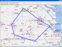
A preliminary throw-it-in-to-get-a-baseline routing in AOPA/RTFP says that's 327 miles, 3 hours 9 minutes, and 29 gallons of fuel. We're aiming for 3 hours of flight time, and the plane holds 38 gallons.
The western part of this route is on the Cincinnati sectional; the rest is on the familiar Washington sectional.
I'll post more as I get into the details...
My task over the next few days is to do the planning. Husband is going with us as a back-seat observer, so the weight and balance will be different from what I'm used to.
I'm going to try to figure out the circular slide-rule flight computer (wowzah) to do it the old way, and of course use an electronic system to do it in a more efficient way (probably AOPA's Real-Time Flight Planner). Of course I'll use ForeFlight to check weather the night before and the morning of the flight.
The route will basically be:
- JGG to the Richmond (RIC) VOR, overfly RIC
- Gordonsville (GVL) VOR up the V38 Victor airway to Charlottesville (CHO), home of Dave Matthews
- Land at CHO (a towered airport), taxi and takeoff
- Head down to Lynchburg (LYH), land, refuel and stretch
- Get to Halifax (RZZ) or another southern-middleish airport, and either land/taxi/takeoff or just overfly
- Back home
If we do go to Halifax, there's a nice big lake south of Lynchburg that would be pretty cool to use for a pilotage leg.
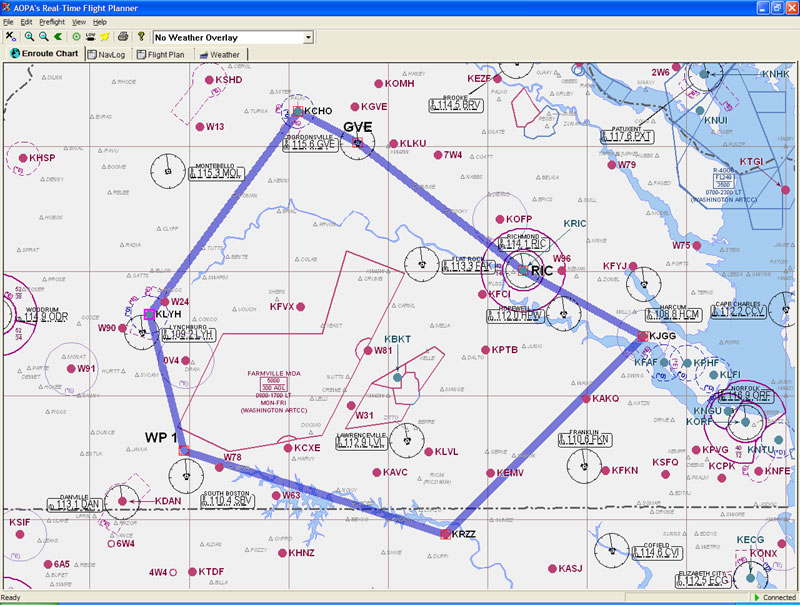
A preliminary throw-it-in-to-get-a-baseline routing in AOPA/RTFP says that's 327 miles, 3 hours 9 minutes, and 29 gallons of fuel. We're aiming for 3 hours of flight time, and the plane holds 38 gallons.
The western part of this route is on the Cincinnati sectional; the rest is on the familiar Washington sectional.
I'll post more as I get into the details...
Monday, November 20, 2006
JEP FII-11: Homework
Homework from last Wednesday was to determine what the "utility" envelope in the W&B graph means.
I checked my textbook, I check a bunch of sites on the web, and unfortunately I don't have the POH with me to see if it gives meaning for it.
Cobbling together clues from these different resources, however, it seems to me that the utility envelope expresses the safe range for maneuvers with a high load factor. I did see one site that said if you're trying to spin an airplane to load within the utility envelope.
The utility range is the lower left corner, which indicates a lighter load with a more forward CG. The lighter load will result in lower load factors for the same maneuvers than would a heavier load, so if you're planning to push the plane or do aerobatics, you'd obviously want to contribute to the load factor by your actions rather than your bulk.
The location of the CG affects aircraft handling. Forward CGs make for more stable aircraft, but too forward a CG increases the stalling speed.
Monday, November 13, 2006
388 W&B
Based on the numbers I have at home for arms and empty weight, our Thanksgiving trip easily falls within the moment envelope, even with 80 lbs of make-believe luggage.
That's right smack in the middle of a line that diagonally bisects the envelope long-ways.
If Husband and I each put on 50 lbs eating Thanksgiving dinner, we're still well inside the envelope.
If I flew and Husband sat in the back with the Dog, we'd be ok.
According to the W&B, we'd be okay if all of us sat in the back! (Wait, who's flying?!?!?!)
We'd be ok if we brought one of my Brothers and his luggage back with us. We'd be ok with three adults, one black lab, 120 lbs of luggage and full fuel. And at that, we've just about maxed out the useful room in the plane without exhausting the useful load!
The constraints for 388 are (1) total weight must be less than 2300 lbs, (2) no more than 120 lbs in the luggage area, and (3) total moment must be less than 109 lb-in. It's pretty flexible within those limits. Husband says this is the most flexible plane for which he's ever done the W&B.
But one point of this lesson was to think about the plane crash from Sunday morning. The couple was on vacation and the crash happened on takeoff. Bad loading of the plane can result in bad takeoff performance. In 388 on a calm and comfortable fall day, a gross weight of 1700 lbs (basically me on a solo flight) has a ground run of 435' and it would take 780' to clear a 50' obstacle. JGG is 3200' long, so that's ok.
Load the plane to a gross weight of 2000 lbs and that ground run goes up to 630' or 1035' to clear that 50' obstacle -- up by ~50%.
Max it out at 2300 lbs and those numbers go to 865' and 1525', roughly double the solo numbers.
Max it out at an altitude of 7500' on a cold day and the distance required to clear that obstacle tops 3800'. I wonder if their numbers are for normal or short-field take-off procedures (it doesn't specify, so I'd assume normal).
Based on the numbers in the take-off data chart in the POH (from whence the numbers above also came), weight has a larger effect than altitude, which has a larger effect than temperature (for 388, anyway).
Bad loading can also cause control ineffectiveness of varying degrees. Weight in general affects load factor, which must be regarded during turns and other situations where the plane is physically stressed.
| Weight (lbs) | Arm (inches) | Moment (lb-in) | |
| Empty weight | 1392.4 | 37.54 | 52270.7 |
| Fuel | 228 (38 gals*6lbs/gal) | 48 | 10994 |
| Oil | 15 (8qts*1.875/qt) | -0.2 | -3 |
| Front | 290 | 36 | 10440 |
| Rear | 95 | 70 | 6650 |
| Baggage | 100 | 95 | 9500 |
| Total | 2120.4 | 89.8 | |
That's right smack in the middle of a line that diagonally bisects the envelope long-ways.
If Husband and I each put on 50 lbs eating Thanksgiving dinner, we're still well inside the envelope.
If I flew and Husband sat in the back with the Dog, we'd be ok.
According to the W&B, we'd be okay if all of us sat in the back! (Wait, who's flying?!?!?!)
We'd be ok if we brought one of my Brothers and his luggage back with us. We'd be ok with three adults, one black lab, 120 lbs of luggage and full fuel. And at that, we've just about maxed out the useful room in the plane without exhausting the useful load!
The constraints for 388 are (1) total weight must be less than 2300 lbs, (2) no more than 120 lbs in the luggage area, and (3) total moment must be less than 109 lb-in. It's pretty flexible within those limits. Husband says this is the most flexible plane for which he's ever done the W&B.
But one point of this lesson was to think about the plane crash from Sunday morning. The couple was on vacation and the crash happened on takeoff. Bad loading of the plane can result in bad takeoff performance. In 388 on a calm and comfortable fall day, a gross weight of 1700 lbs (basically me on a solo flight) has a ground run of 435' and it would take 780' to clear a 50' obstacle. JGG is 3200' long, so that's ok.
Load the plane to a gross weight of 2000 lbs and that ground run goes up to 630' or 1035' to clear that 50' obstacle -- up by ~50%.
Max it out at 2300 lbs and those numbers go to 865' and 1525', roughly double the solo numbers.
Max it out at an altitude of 7500' on a cold day and the distance required to clear that obstacle tops 3800'. I wonder if their numbers are for normal or short-field take-off procedures (it doesn't specify, so I'd assume normal).
Based on the numbers in the take-off data chart in the POH (from whence the numbers above also came), weight has a larger effect than altitude, which has a larger effect than temperature (for 388, anyway).
Bad loading can also cause control ineffectiveness of varying degrees. Weight in general affects load factor, which must be regarded during turns and other situations where the plane is physically stressed.
Canceled and homework
The clouds didn't lift like they were supposed to, so we've canceled today's lesson on account of a 1000' ceiling.
For Wednesday, I've got homework: do the weight and balance for our up-coming Thanksgiving trip. We'll be taking the Dog (~90 lbs) and while we try to travel light, for this exercise I'm to give us each a 40-lb suitcase. We've got the, er, what do you call them? The distance from the datum to the loading point... That distance times weight is the moment, compare totals to POH W&B envelope... What are those distances called? Arms? Arm length? Anyway, we've got all of that info at home and I've done it before using our family members as ballast for their visits, so it should be easy enough. Husband turned it all into a spreadsheet, too, so I'll do it both ways.
For Wednesday, I've got homework: do the weight and balance for our up-coming Thanksgiving trip. We'll be taking the Dog (~90 lbs) and while we try to travel light, for this exercise I'm to give us each a 40-lb suitcase. We've got the, er, what do you call them? The distance from the datum to the loading point... That distance times weight is the moment, compare totals to POH W&B envelope... What are those distances called? Arms? Arm length? Anyway, we've got all of that info at home and I've done it before using our family members as ballast for their visits, so it should be easy enough. Husband turned it all into a spreadsheet, too, so I'll do it both ways.
Subscribe to:
Comments (Atom)